The Route.
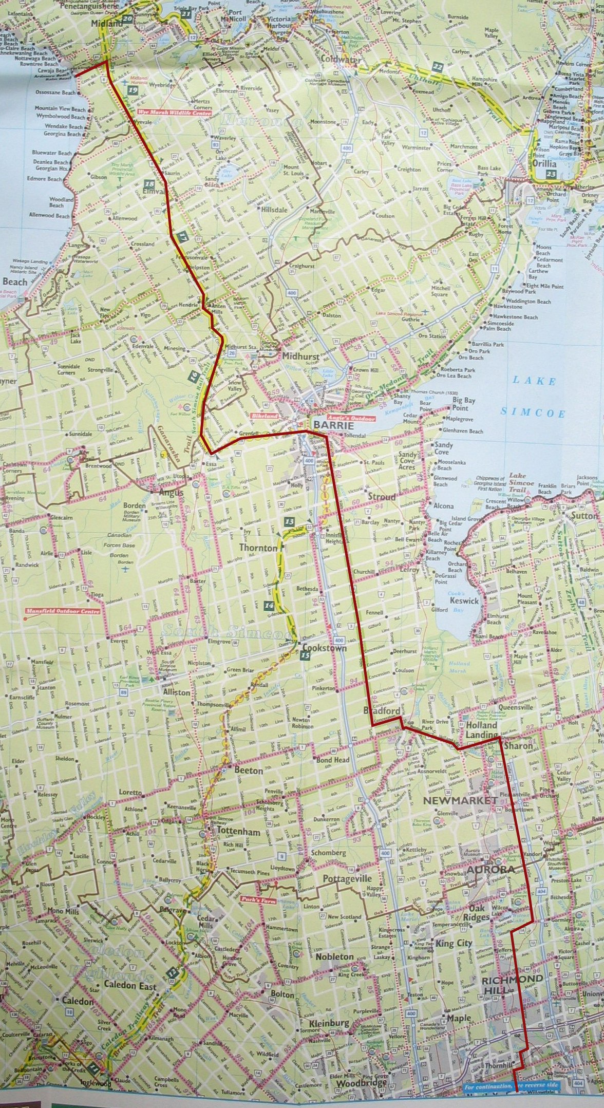 A while ago, I mentioned that I was going to head up
to Balm Beach on my bicycle. Well, the date has been set, and it's
this coming Saturday. I've done a couple of successively longer rides
after the 87km Musselman Lake ride, a 103km ride out to Holland
Landing and back, and a 126km ride up to Keswick and back. I've
planned out a route (see right), and think it should be a long, but
do-able ride. It's a little bit longer than my longest ride (which
was yesterday, up to Keswick and back), but I'm going to start earlier
(8:00am from Steeles, instead of 9:00am from Finch), and I don't mind
finishing later. (I finished the Keswick ride, including taking the
subway home from Finch, at 5:30pm, but these days, it's light out
until almost 9:00pm. I don't really want to be biking for 13 hours
continuously, but it's good to know that the option is there, if I
decide to stop for a really long lunch, or something.)
A while ago, I mentioned that I was going to head up
to Balm Beach on my bicycle. Well, the date has been set, and it's
this coming Saturday. I've done a couple of successively longer rides
after the 87km Musselman Lake ride, a 103km ride out to Holland
Landing and back, and a 126km ride up to Keswick and back. I've
planned out a route (see right), and think it should be a long, but
do-able ride. It's a little bit longer than my longest ride (which
was yesterday, up to Keswick and back), but I'm going to start earlier
(8:00am from Steeles, instead of 9:00am from Finch), and I don't mind
finishing later. (I finished the Keswick ride, including taking the
subway home from Finch, at 5:30pm, but these days, it's light out
until almost 9:00pm. I don't really want to be biking for 13 hours
continuously, but it's good to know that the option is there, if I
decide to stop for a really long lunch, or something.)
The cue sheet looks something like this:
| At | Dist | Turn | Location |
|---|---|---|---|
| a | 0 (or 2.1) km | R | Steeles |
| b | 1.1 (or 3.2) km | L | Henderson |
| c | 2.8 (or 4.9) km | R | John |
| d | 3.7 (or 5.8) km | L | Bayview |
| e | 16.4 (or 18.5) km | R | Stouffville |
| f | 18.6 (or 20.7) km | L | Leslie |
| g | 37.6 (or 39.7) km | L | Mount Albert Road |
| h | 41.6 (or 43.7) km | L | Yonge |
| i | 42.1 (or 44.2) km | QR | Holland Landing Road turns into Bridge Street |
| j | 48.2 (or 50.3) km | VL | Holland Line West |
| k | 48.9 (or 51.0) km | R | Barrie Street |
| l | 50.2 (or 52.3) km | L | 8th Concession |
| m | 53.4 (or 55.5) km | R | 10th Sideroad |
| n | 81.9 (or 84.0) km | L | Burton Ave |
| o | ??.? km | ? | A trail, or Highway 40 |
| p | ??.? km | R | North Simcoe Rail Trail |
| q | ??.? km | O | Balm Beach Road |
I'm not exactly sure what's going on at step "m", so I figure I'll
wing it, depending on how the trail looks, or if there even is a trail
there.